What a 1927 cable map taught me about culture, power and the digital world
Last week I visited the British Library exhibition Secret Maps. It was my first proper visit there – apart from a slightly embarrassing trip years ago when I arrived for a meeting only to realise I was meant to be at the British Museum – a story for another time perhaps!
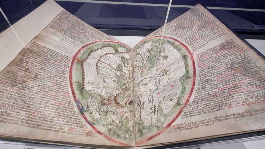
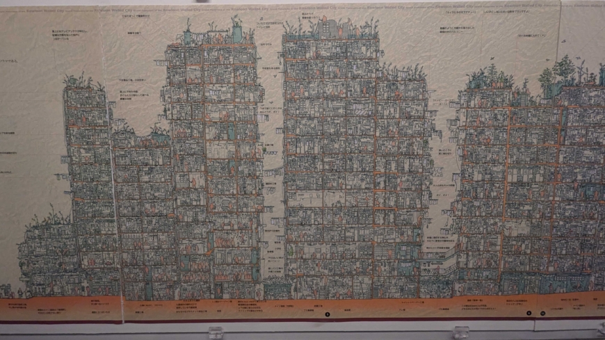
The exhibition was rich with detail and quiet drama. There are beautiful medieval maps with hand painted illustrations, a jaw dropping cross-section of Kowloon Walled City in the 1990s, and many examples of how maps are often as much about what is concealed as what is revealed.
But one map in particular caught my attention.
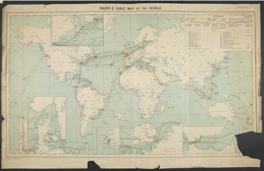
It showed the network of global communication cables lying on the seabed in 1927.
Today, these cables are fundamental to how the internet works and, by extension, how I earn my living. I’m interested in the physical infrastructure that sits beneath what we casually describe as “the cloud”. I am also conscious of how fragile this infrastructure can feel in times of heightened international tension.
What struck me most, however, was not simply the existence of the cables, but what their routes revealed about a world caught between two world wars that would reshape history.
The map showed dense connections between the UK and the United States – particularly New York – and across to mainland Europe. It was a visual representation of where trade, finance and political influence were concentrated.
Then I noticed what wasn’t there.
There were very few connections to Norway.
As someone who is half Norwegian, I found myself drawn to that absence. It was a reminder of where the country sat in global economic terms a century ago. Out of curiosity, I later searched for a modern equivalent of the map. What I found backed up what I thought – a reversal of fortunes. Norway is now one of the most digitally connected countries in the world, with dense networks linking it internationally.
The contrast was striking because it made visible how dramatically the centres of connectivity ,and therefore opportunity, can shift over time.
The exhibition also prompted me to think about how layered our infrastructure has become. We no longer rely only on cables beneath the sea; we also depend on satellites orbiting above us. Each layer brings resilience, but also new forms of vulnerability. Interestingly, there were almost no “secret maps” of space in the exhibition, apart from a delicate and rather beautiful medieval map of Ursa Minor drawn as a bear.
What I took away from Secret Maps was a renewed awareness that technology is never neutral. The routes we build – whether physical cables, data networks or digital platforms – reflect who holds power at a given moment in time. And in turn, those routes shape how culture, commerce and communication flow.
Cultural organisations can often be seen as the “content” layer of the internet, but they are also deeply affected by its infrastructure: by who is connected, how reliably, and on what terms. The digital experiences we design today sit on top of systems that were shaped by decades of political, economic and technological decisions.
At HdK, we spend our time building websites, digital campaigns and platforms for cultural organisations. It’s easy to focus only on the surface: the design, the messaging, the user journey. But exhibitions like this are a useful prompt to think more deeply about the networks beneath it all – and about the responsibility that comes with shaping how culture travels in a digital world.